Lake St Clair / leeawulenna
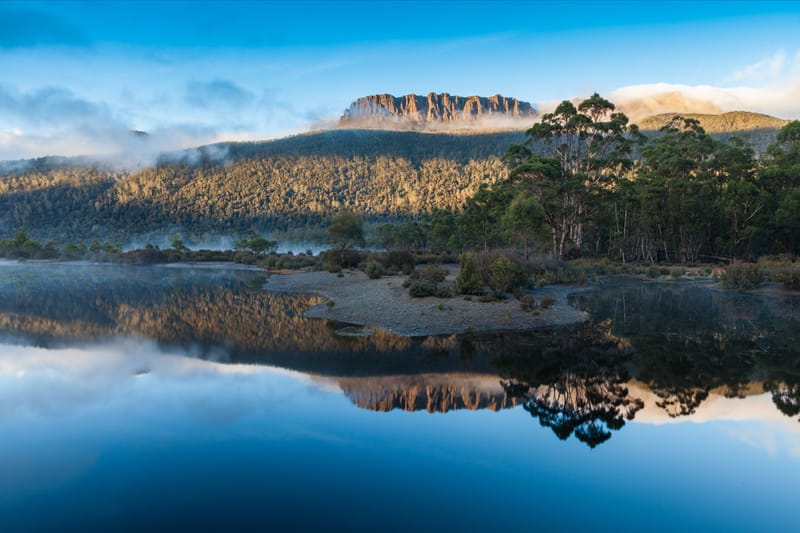
Lake St Clair or leeawulenna is a natural freshwater lake located in the Central Highlands area of Tasmania, Australia. The lake forms the southern end of the Cradle Mountain-Lake St Clair National Park. It has an area of approximately 45 square kilometres (17 sq mi), and a maximum depth of 215 metres (705 ft), making it Australia's deepest lake.[1]
The lake is fed by Narcissus River, Cuvier River, and Hamilton Creek and marks the start of the River Derwent.[2]
The locality of Lake St Clair is in the local government areas of Central Highlands (24%), Meander Valley (12%), and West Coast (64%). The southern end of the lake is about 106 kilometres (66 mi) north-west of the town of Hamilton.[3]
History
Lake St Clair is located on the edge of the Big River Tasmanian Aboriginal nation, and there is evidence that they hunted on the surrounding button grass plains. Numerous small quarries and campgrounds are located nearby, with the closest dated site putting human occupation at 10,000 years ago.[4][5]
The first European explorer to see the lake was surveyor William Sharland in 1832, with George Frankland leading an expedition to it three years later. In 1840 James Calder cut a track from the lake to Macquarie Harbour, followed by another more practical track by Burgess. The Burgess track was maintained and re-cut by miners until 1883 when a new lower level route was discovered, which later became the Lyell Highway.[5]
The area surrounding the lake was used by snarers and hunters from 1860 until the collapse of the fur trade in the 1950s, although it was illegal from 1927 onwards.[5]
In 1937 the Derwent River was dammed just below the lake, and a pumping station installed - enabling Hydro Tasmania to drain the lake up to 6 metres and feed water to the Tarraleah Power Station. The fluctuating water levels have caused erosion and environmental degradation since.[5] The pumphouse was decommissioned in the 1990s, and transformed into a hotel in 2015.[6]
The Cradle Mountain-Lake St Clair area was declared a scenic reserve in 1922, a wildlife reserve in 1927, a national park in 1947 and a world heritage area from 1982.
- On the 5th of February 2023 Rod Watkins and Sam Poulsen were the first recorded swimmers who have swum unassisted the length of Lake St Clair from the North shore to the South Shore. Distance 14km in temps starting at 11°C and warming to 16°C at the end. The true distance of the Lake St Clair swim is 14km.
- On the 16 April 2024 James Walker swam assisted from the mouth of the Narcissus River North of Lake St Clair to the Jetty at the Southern end of Lake St Clair nearest to Lake St Clair lodge. James swam the 14km swim in a time of 4hrs 48min 24sec. James temperatures ranged from 8.5c at Narcissus River to 12.6c at the Lake St Clair Lodge Jetty.
Although it is known that other swimmers have swam the lake, but these swims have not been documented and Sam Poulsen to our knowledge is the first female swimmer to have swum for North shore to the South shore of the Lake.
Click here to register